


Upwelling About
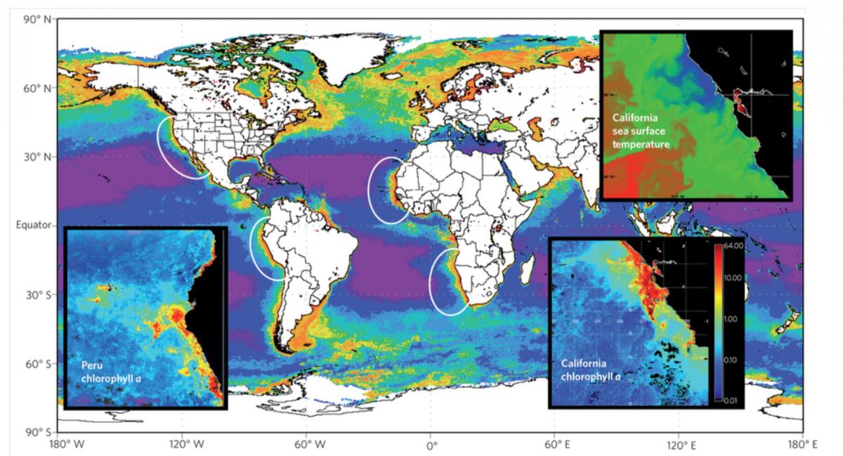
A global false-colour compilation of satellite data on ocean chlorophyll from the MODIS Aquasensor for the year 2011 showing the California, Peru, Canary and Benguela ecosystems (white ovals). Satellite imagery courtesy of NASA. From Capone and Hutchins, 2013
Upwelling systems bring nutrient rich waters from the deep ocean to the surface. Areas of upwelling are often associated with highly productive oceanic regions, offering great economic value in terms of fisheries (see satellite image above showing surface chlorophyll concentrations off the west coast of America). Regions of upwelling are located in equatorial (Inter Tropical Convergence Zone, ITCZ) and coastal (eastern Pacific and Atlantic) regions of the ocean. Upwelling is driven by ocean surface winds. Consequently climatic events, causing shifts in prevailing winds (e.g. El Niño, the Indian Ocean Dipole and Tropical Atlantic Variability) can cause variations and reduction in the strength of upwelling systems. Present models of upwelling systems show large biases, impacting climate simulations. Consequently there is a need to identify the key physical processes that are responsible for upwelling and improving their representation in models.
Download: Revised Prospectus for CLIVAR Research Focus on Eastern Boundary Upwelling Systems (RF-EBUS) (2018)